
Mesylab
Diagnosis and anticipation of changes in geographic information usage
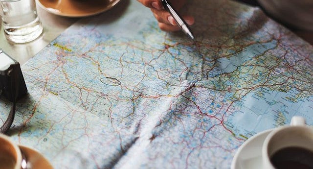
Geographic information, whether in paper form or computerized form, is increasingly used by the actors of a territory, whether they are public or private organizations. In this context, the Department of Geomatics of the Public Service of Wallonia needed:
- to get a good overview of existing practices to integrate and coordinate them,
- to bring the tools and data produced closer to the expectations and needs of users,
- to reach an agreement on the standardization of the production of geographic information in order to be able to compare and integrate data.
Mesydel platform was used for a two-round survey of stakeholders (companies and public organizations) to achieve these goals:
- Decision support in the context of a rapidly changing sector
- Harmonization and standardization of methods among a wide range of actors
- Awareness of Walloon society on the strengths of geomatics
- Survey of the participatory dimension of geomatics approaches
Our partner
The Department of Geomatics is a service of the Public Service of Wallonia (SPW), the central administration of the Walloon Region (Belgium). It represents Wallonia at the regional, interregional, national and international levels in the technical fields related to geographic information. It is the main coordinator of the user communities and deals with training, awareness, research projects, workshops, etc. Within this department, the Geodata Integration Department (DIG) deals more specifically with the implementation of the European directive Inspire and the decree relating to the Walloon information infrastructure. The DIG ensures the diffusion of data, promotes the role of geomatics in decision-making processes and coordinates the production and use of geographic data and tools.
Context
The rapidly expanding geomatic sector has profoundly changed the practices of both public and private actors. The practices are evolving as each of the actors develops its own modes of operation and tools. It is therefore important to harmonize this heterogeneity. Geographic information is increasingly being used, and the new acquisition and processing tools lead to new technical challenges, both in the integration of disparate databases and in the quality of the processed data (real-time updating, data accuracy, etc.).
Since the adoption of the Walloon Geographic Information Infrastructure Decree (InfraSIG) on December 22nd, 2010, the Walloon Region is committed to developing the necessary tools for the geomatics transition. In this context, the Public Service of Wallonia wished to develop a Strategic Plan for Walloon geomatics, which aims to operationalize the InfraSIG Decree. The design of this plan faced three main challenges:
- Coordinating a very disparate set of actors: a clear diagnosis was needed, of the geomatics stakeholders, how they work and what are their expectations of the tools developed by the Department.
- Harmonizing and optimizing evolving practices: many problems or slowdowns are linked to inaccurate, misused or underutilized geographic data. The SPW therefore wished to develop technical devices to operationalize the coordination and diffusion of this information.
- Standardizing information produced for integration purposes: due to the disparity of the production methods and the media (papers, software) used, databases are difficult to integrate. The objective was twofold: to agree on a way of structuring information; and to ensure that the tools and practices of each are recognized and integrated by the new structure.
Mesydel intervention
The consultation took the form of a qualitative survey in two rounds, a first round in May 2013 and a second round in June 2013. The intervention of Mesydel took place in 5 main stages:
- Identification of the panel: 1100 people were invited, and 385 respondents were finally involved, giving a participation rate of 35%. Respondents came from a wide range of backgrounds: Public Service of Wallonia (SPW), Municipalities, Public interest organizations, Individuals, Study offices, Private firms, Educational and/or research establishments, Police, Provinces, Service Associations, Public Organizations and the French Community.
- Definition of survey strategy: open-ended questions were mainly used with the objective of qualitative treatment. Anonymity allowed each of the stakeholders of the sector to be heard and to give their opinion freely. The consultation thus made it possible to survey both producers and users of geographic information, traditional actors in the sector and new or potential actors.
- First round of questionnaire: it gave rise to a fairly large first collection of opinions to validate or invalidate the prior hypotheses. It also highlighted what worked well in current tools and practices and what remained to be improved.
- Second round of questionnaire: the second round was used to dig the problematic or poorly documented points that emerged during the first round. More technical aspects were discussed with the participants, notably on the justifications of their practices, or on the participatory dimension of the tools, that is to say, how each person appropriates the tools and is involved in the production and the analysis of geographic information.
- Final synthesis: the information gathered from the panel of participants was used as a support for the construction of an inventory and for the main lines of action of the Strategic Plan of the Department of Geomatics.
Results
The survey made it possible to approach users of geographic tools and data very closely in the Walloon Region, to obtain a precise view of the main issues in their uses, and to co-construct a strategic line for the coordination of a rapidly evolving sector.
- Overview of the heterogeneity of geomatics actors, tools and practices. Some fractures have been identified, between types of users and between territories. A typology has thus been obtained according to the way in which the actors use the geographical information. The qualitative analysis allows to approach precisely the users, to understand and justify their choices and their needs: more or less strong skills, strategies of arrangements and games between different tools, ease of access to certain databases, etc. Recommendations could be provided on this basis to redefine the objectives of the Walloon Geoportal, the website of Walloon geographic information, in order to better link it to these clearly defined target audiences.
- Identification of priorities for the future development of Walloon geomatics strategy and, in particular, for its operationalization. Users’ expectations have been highlighted, both in terms of the data themselves and of the technical processes and tools related to their production and analysis.
- Definition of a software strategy. The consultation highlighted what worked well in the existing practices and the complementarity of the tools in order to enhance them. It helped to identify areas for improvement and to explore the question of switching to Open Source, directly with the concerned actors. The question of the tools’ over-dimensioning has been documented in relation to the different profiles and the different expectations of the actors. The results of the survey are valuable prerequisites for the drafting of a genuine software policy at the scale of Wallonia, with the aim of making geomatics more accessible.
- Definition of a strategy for standardization and integration of geodata. The means of participation in crowd-sourcing were evaluated. Several very technical aspects were discussed with the participants, notably concerning the right balance between quality and availability of data, the importance of metadata in decision-making and the phenomenon of data scarcity that occurred in some specific cases. A classification and data organization structure has thus emerged, based on the usage (analytical, legal, reality) that the concerned actors have and will have.
Contact
References
Video describing the project (in French) : “L’ULg au service de la géomatique wallonne” (ULg).
Scientific article (in French) : http://pyramides.revues.org/1014